|
7. Phenology
It's all a matter of ecology, meteorology, latitude and altitude
Phenology is the study of the timing of recurrent life cycles (plants and animals) and how these are influenced by seasonal and interannual variations in climate and habitat factors. It often makes use of long-term records and studies different events (e.g. flight period, first date of emergence, peak appearance, last appearance, annual migration, …)
The growth and development of butterflies and plants is closely related to temperature.
Butterflies and plants use “internal clocks” as there is a significant contribution of genetics to phenology traits. The length of the day, fluctuating throughout the year but always identical at a single locality on the same date, determines an average date of recurrent events but not a yearly variation.
Many of these phenomena are sensitive to changes in temperature, rainfall, humidity, …
Phenology is also involved in studies of the recurrent life cycle events in different localities in the same time frame. It is influenced by latitude, altitude, slope etc. Weather conditions have a great influence on recurrent events and are responsible for yearly variations. Previous weather conditions will influence these local events for resident species.
For migratory butterflies such as Vanessa cardui, arrival dates are more influenced by the conditions at the starting locality and on the way during their migrations.
Climate change and global warming have an effect on the life cycles of many butterfly species.
First appearance and peak appearance has advanced for most butterflies. Butterflies having multiple generations also seem to have longer global flight periods.
An increase by 1°C advances first and peak appearance for most butterflies by 2-10 days.
Since the early 1970’s the seasonal development has generally advanced by about 10 days.
Long term recorded emergences and event dates provide a lot of information in weather patterns.
Some insects that were single-brooded now produce two or more generations per year.
Phenograms can visualize in what period of the year adult butterflies are observed but the method of data collection over many years obscures the differences from year to year. This is clearly illustrated in Bink (2015)
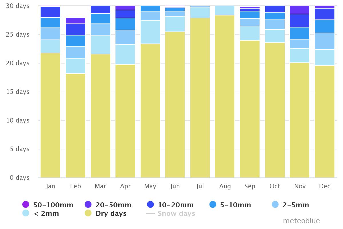
The lack of long-term data collection and the important differences in climate (Fig. 1a-f: Fig. 3a-f) and geography of Albania, make it impossible to produce relevant phenograms at country level.
In the monographs we will provide general information about the life cycle: the range in number of broods per year and information about the length of the early stages.
The modeled average climate data for Tiranë (Fig. 1a-f) give a first impression of the climate in Albania but are not relevant for other regions in the country.
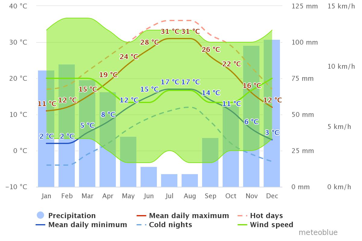  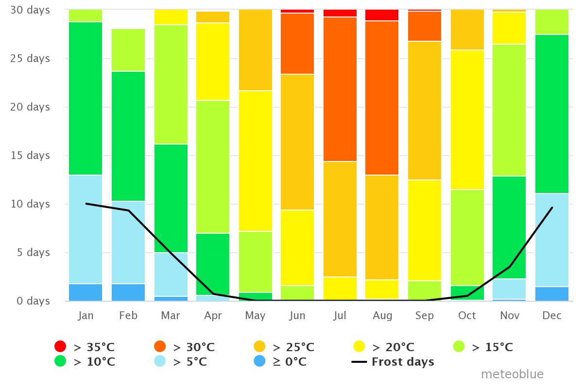
1a.
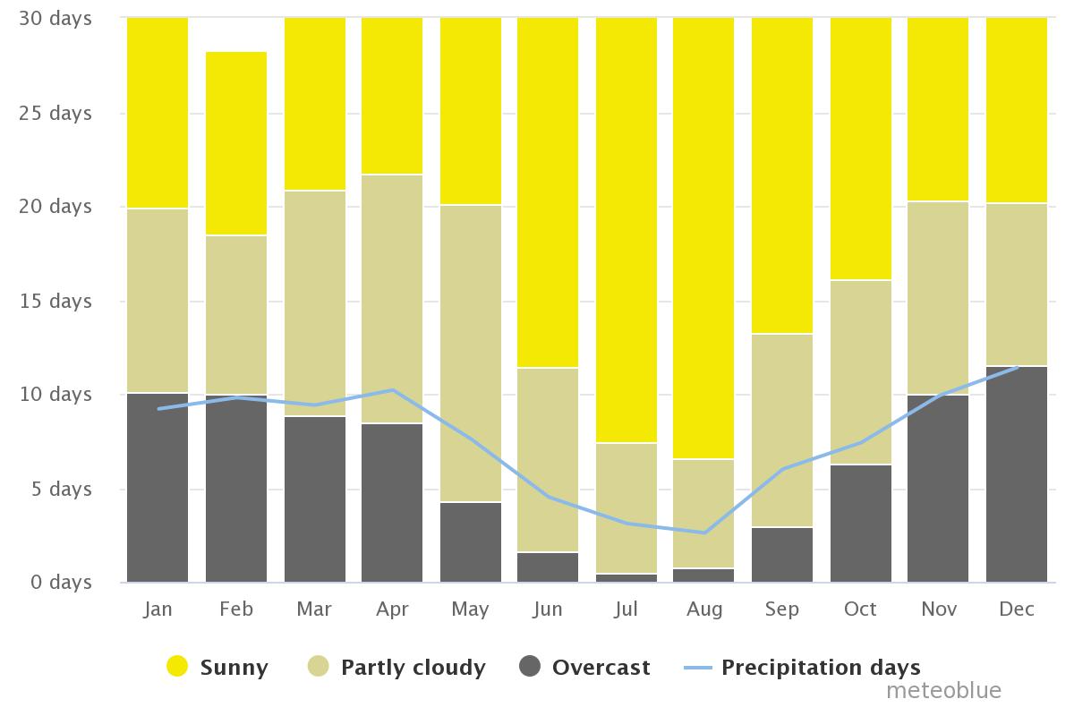
1b. Average # cloudy, sunny and precipitation days in Tiranë
1c.
1d.
1e.
1f.
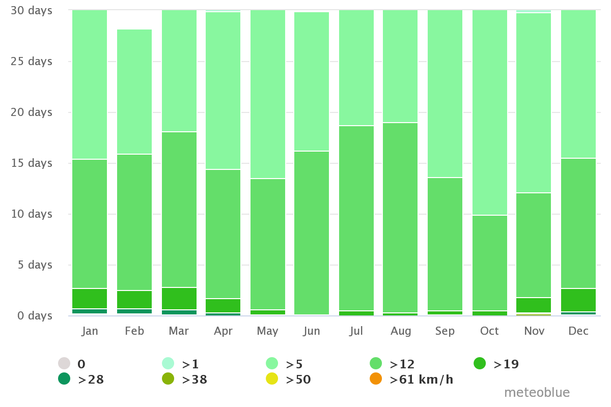
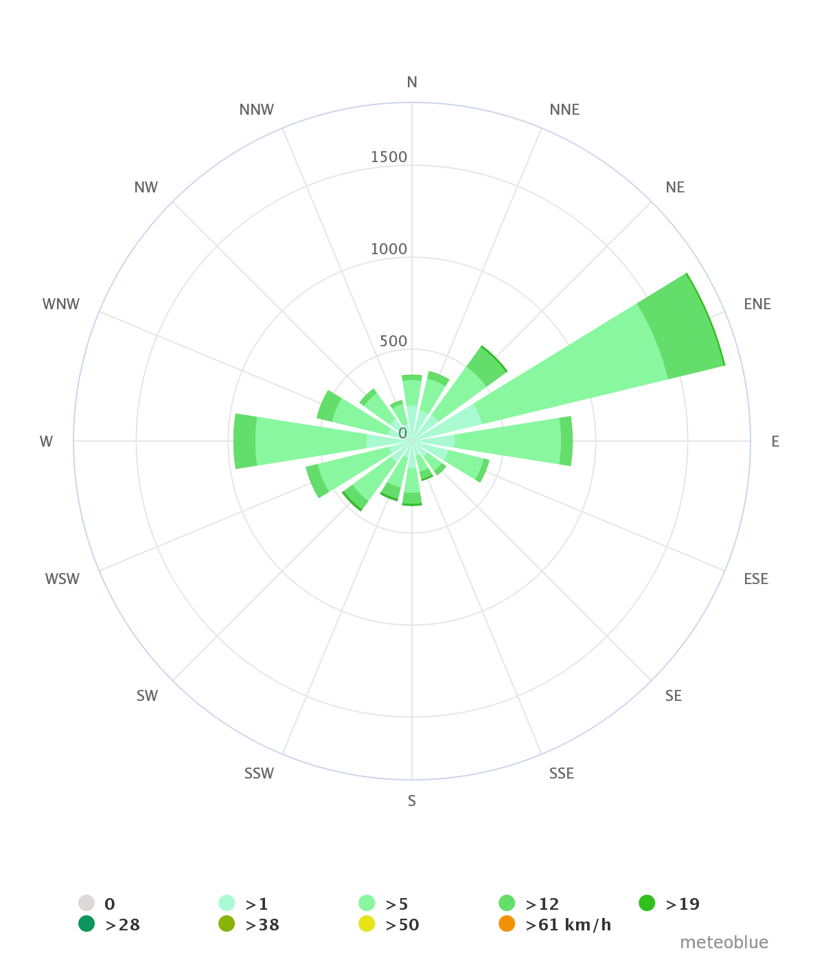
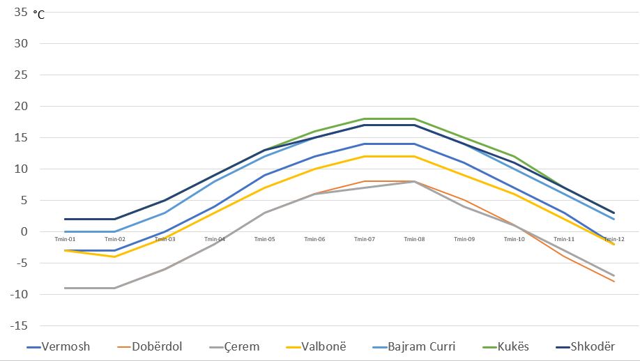
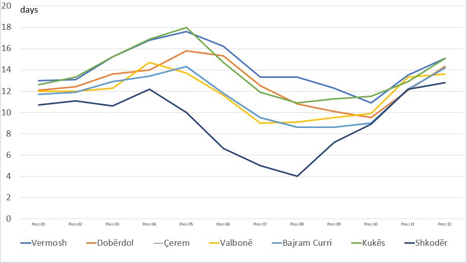
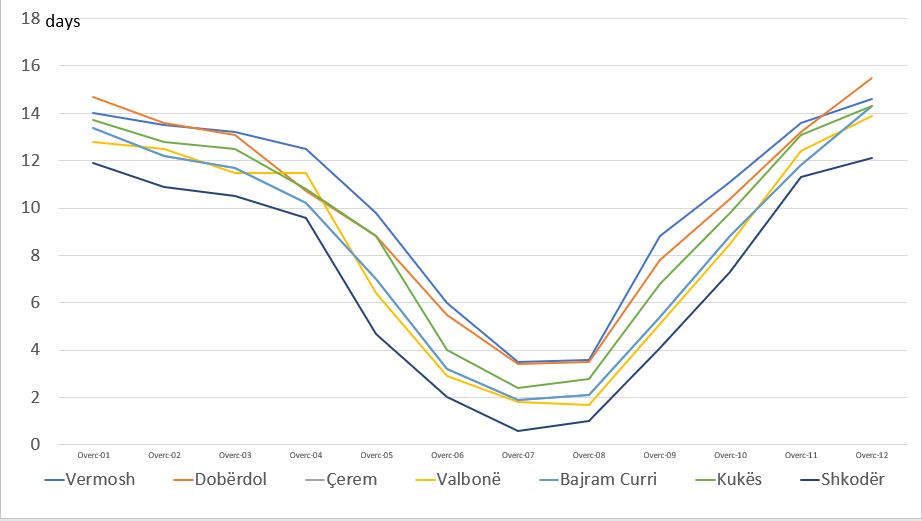
At a regional level, e.g. northern Albania, meteorological variables such as averages for Tmax, Tmin, # sunny days/month,# precipitation days/month, mm rain/month and
# precipitation days/month (based on 30 years of hourly weather model simulations: open source: meteoblue) provide a comparison of the local climate for selected localities (Table. 1, Fig. 2) and show clear differences (Fig. 3a-f)
| Locality |
Coordinates (decimal degrees) |
Altitude |
| Vermosh |
42.59 19.69 |
1.055 m asl |
| Dobërdol |
42.54 20.06 |
1.875 m asl |
| Kodra Mijushës |
42.48 19.95 |
1.756 m asl |
| Valbonë |
42.45 19.89 |
932 m asl |
| Bajram Curri |
42.36 20.07 |
362 m asl |
| Kukës |
42.08 20.42 |
351 m asl |
| Shkodër |
42.06 19.50 |
7 m asl |
Table. 1. The selected localities in northern Albania with decimal coordinates and altitude.
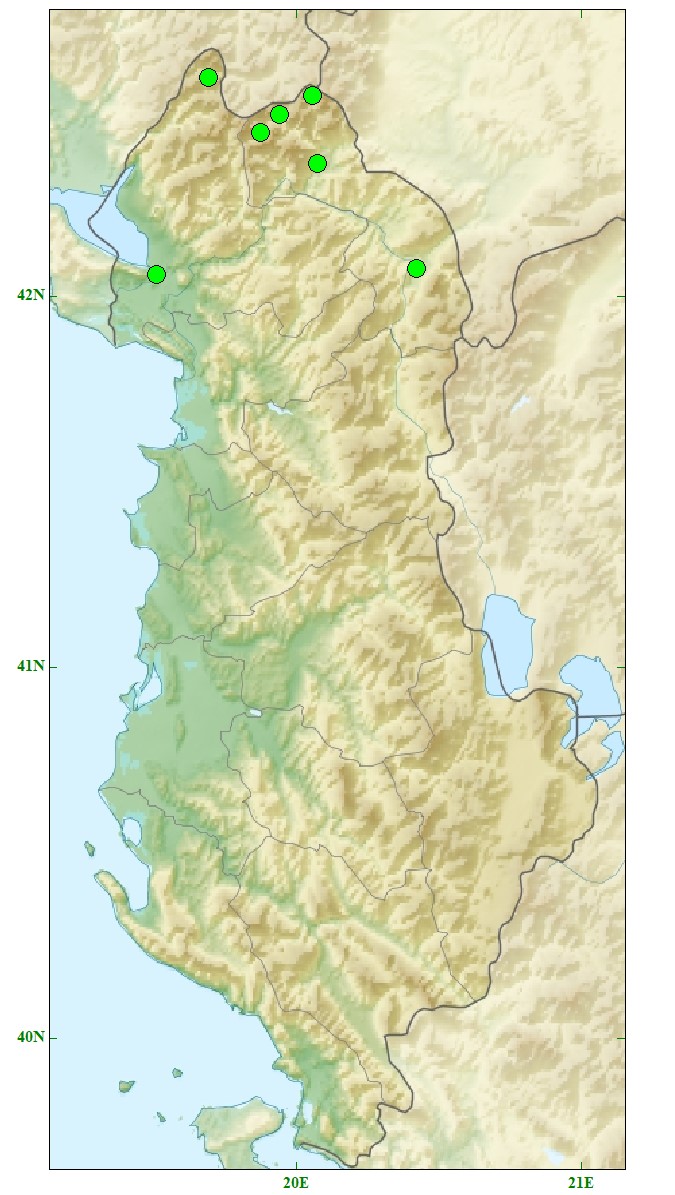
2. Map of the selected localities in northern Albania ()
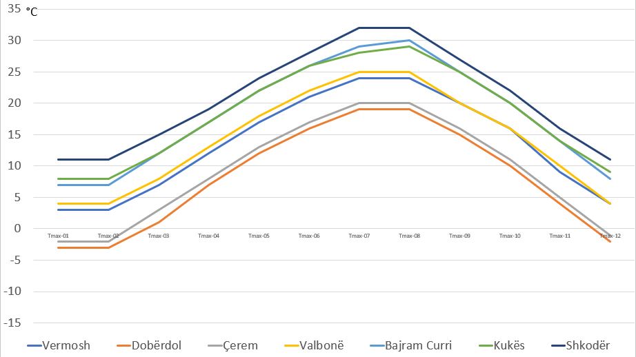 
3a. Modeled average Tmax (source meteoblue, adaptations SC on 5.xi.2022
3b. Modeled average Tmin (source meteoblue, adaptations SC on 5.xi.2022,)
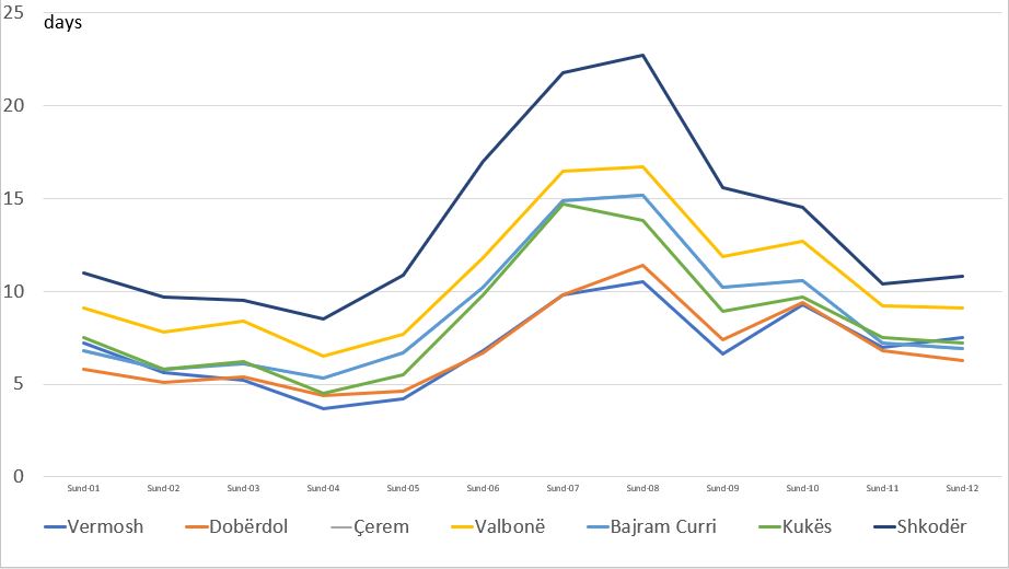 
3c. Modeled average # sunny days (source meteoblue, adaptations SC on 5.xi.2022, )
3d. Modeled average # precipitation days (source meteoblue, adaptations SC on 5.xi.2022,)
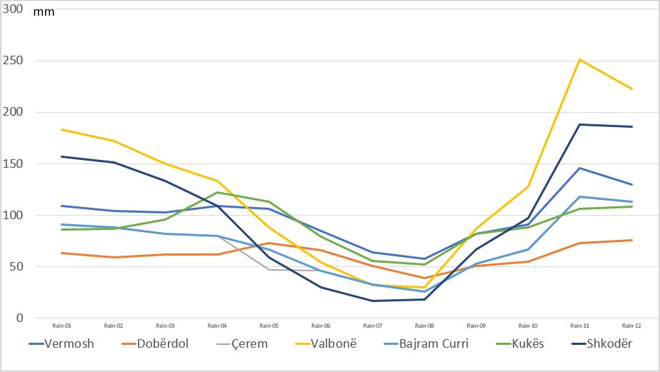 
3e. Modeled average mm rain/month (source meteoblue, adaptations SC on 5.xi.2022, )
3f. Modeled average overcast days (source meteoblue, adaptations SC on 5.xi.2022
Contact
|
 xx
xx xx
xx